 The Great Ocean Road is 243km long, or 151 miles, and starts (officially) in Torquay and ends in Allansford. You can drive either way. We are driving Allansford to Torquay, primarily because we are coming from Adelaide and heading to Melbourne. We discovered an advantage of that route today as it is the road less travelled, less cars and tour buses going our way! Slight disadvantage as we hugged the cliff side and not the seaside for best views but really not much in that much in it.
The weather was not our best friend today. Started with drizzly misty rain on and off and ended with heavy rain.
Leaving Port Fairy and our lovely digs and breakfast, we passed through Warrnambool, the biggest town in the area, and notable to us for the large Fonterra factory as you drive in!
The most impressive features of the Ocean Road are the sculptured sandstone rocks and stacks, largely found in quick succession in one section of the drive. Our first stop on the road was The Bay of Islands. A collection of rock stacks, sheltered bays, views and beaches, it was a promising start in fine conditions. The Bay of Martyrs was next and equally as impressive. Calm seas and clear contrasts of colours.
 The Grotto, one of my favourite spots was next. It is a cave and sinkhole about halfway up the cliff from sea level. A path leads to a decked staircase that takes you down to view rock pools and the sea beyond the carved out of jagged edge limestone. Stunning.
 The next formation, fashioned by the rain, wind and waves, was London Bridge, which previously featured a double arch. Apparently when the inner arch collapsed in 1989, two people were stranded in the other side and were rescued by helicopter. The remaining arch has a large flat top, slightly tilted to the sea.
The Arch nearby is just that but impressive as it hugs the cliff. It is the middle stage of an island transitioning from tunnel to arch, which will ultimately collapse to form two rock stands.
Lord Ard Gorge is a beach inside a gorge. It looks out towards the site of the Lord Ard shipwreck in May 1878. 54 people were on board. Two survived. The captain thought he was 50 miles out at sea! There are several walks in this area and two notable rock formations. The Razorback is very impressive. Aptly named.
 The Twelve Apostles! The most well known formations. Yes there are 12 but you have never been able to see them all from the current viewing platform. To the west 7 stacks are clearly visible with a further 2 to the east. The others are hidden by headlands and other stacks. Only the 2 to the east are individually named-Gog and Magog. We got somewhat wet on our way out to the rocks. As you will see in the photos the sky is very dark and the photos also. There was a glimmer of sun briefly on the way back so have included all the photos as some interesting light and shade. Bit of a pity about the weather! Interesting story about why the 12 Apostles- see the photos.
We skipped the 89 Gibson Steps to the beach, 1.1km from The Apostles, due to the inclement weather. It would have been nice to view Gog and Magog from beach level though!
 The next part of the trip heads inland a little through part of the beautiful rain forest of the Great Otway National Park. There are Myrtle Beech, Blackwood, Gums and tree ferns in thus part of the large dense forest. Truly stunning in its own way and glistening in the rain! Decided at this point to also skip a trip out to Cape Otway given ever changing weather and poor visibility.
Got to Apollo Bay for lunch (halfway) and it teemed down. Enjoyed some more Mahalia coffee and watched the rain. Just before Apollo Bay is the Southern most point of the Ocean Road.
Got to Lorne mid afternoon. Brief break in the weather to check out the jetty and the old hotel (1875) before dinner.
Unfortunately today was also too wet to stop at Kennett River to go koala watching along the Grey River Road apparently well known for viewing koalas in a patch of preferred Manna Gums.
Great Ocean Road Photos
 Stunning high 20s weather the first day, enjoyed the sunrise and hot air balloons going past the window- nice when you are 40 floors up. Took the free city circle tram around the central area, walked through the gardens, around the Yarra loop between city bridges and along city streets. See info on Angel Sculpture and The Federation Bells below.
 Lovely old buildings and facades being preserved. Multiple cranes at work in the city. Plenty of nice restaurants and coffee places to choose from. Checked out a couple of bars and caught up with people.
 A little bit of rain early morning today has cleared for a walk around the city and down to the docklands to enjoy the developments and sculptures.
 Really wanted to see a couple of exhibitions and the domed La Trobe Reading Room at the “open as usual” State Library Victoria however those features were closed when we got there as builders were making too much noise! Disappointing as only a few paintings to look at amidst millions of books. The item showing fallow deer at Richmond Park took my fancy though seeing some happy hours were spent there when in London!
 Great dinners here at Kenzan, No 35 and Chin Chin. Enjoying the lights across the way tonight at Melbourne Arena-apparently it’s Monster Jam!
 Stopped just short of Aireys Inlet where the Memorial Arch spans the Great Ocean Road, as a reminder that this roadway is the world’s largest war memorial.
 The Split Point Lighthouse and a dramatic looking house (?) stand out on the next section of road at Aireys Inlet itself.
 Stunning views though from our hotel room on the 4oth floor over the Yarra and out to Port Phillip Bay, MCG, Rod Laver Arena, gardens and cityscapes.
 A drizzly wee start to the day after initally positive looking sky! Slower start with brekky and then off to suss out the highly rated Mahalia Coffee Roastery. A quirky little destination cafe and roastery with a whole lot more including all things coffee related, lovely gifts, a children’s playground and outdoor eating area if it was fine! Bought very nice coffee to go and salted caramel yo-yos!
 Lovely drive through very scenic country, green sheep and cattle stations and glimpses of the coast, to Mt Gambier. Drizzly rain and a few heavy showers most of the way with some fine spells. Rain as we arrived at Mt. Gambier meant lunch first and then conveniently it was fine for exploring the Sunken Cave Garden and the Umpherson Sinkhole – also a garden in a sinkhole.
 Some heavier rain but cleared by the time we reached Port Fairy. With more than 50 buildings classified by the National Trust and many fine examples of 1800s architecture, Port Fairy is a lovely little fishing spot (crayfish and abalone) at the start/end of the Great Ocean road depending on which way you are going. Our accomodation is part of a property with a heritage listed house dating back to 1852. Douglas House has variously been a hotel, steam flour mill, post office and warehouse and is now a private residence. The property runs down to the lovely Moyne River and is downstream of a very cute little marina. Port Fairy has wide streets lined with nineteenth century fully restored white-washed cottages built by whalers and seamen alongside Georgian-style merchants’ homes, grand public buildings, huge Norfolk pines and old stone churches.
 We took a lovely late afternoon walk around Griffiths Island where a colony of short-tailed shearwaters (muttonbirds) have their home. The birds apparently arrive within 3 days of the 22nd September each year, settle in last years burrow, mate in early November, lay eggs in burrows about the 25th November and the young appear mid-January. In mid April they head off on their annual migration around the Pacific travelling an estimated 15,000 kms in 2 months. Also beautiful scenery and a lighthouse on the island.
 Great coffee and brekky at Codys to start the day. A howling wind in Noarlunga today so my jetty walk was a little challenging especially out at the end and out of the shelter of the cliffs. Had to hang on tight! Could see how the reef would be great viewing from out there but way too churned up today.
 Got to Kingston late avo for a quick look at Larry the Lobster (town icon representing the lobster fishing industry in the area) and also the old Cape Jaffa lighthouse.
 A stone obelisk was built on Cape Dombey, above the marina, in 1852 to assist ships to navigate safely into the bay. The coast is pretty rugged out to the Southern ocean and it’s easy to see why there were a number of shipwrecks along the coast here. An automatic lighthouse was built on higher ground in 1973.
 Short drive late avo to Port Noarlunga, a little seaside village south of Adelaide. Pretty dull afternoon though as rain sprinkled us. Nevertheless, interesting weaving along the coast enjoying the burbs and the lovely houses along the way. Nice beaches along the length of Holdfast Bay – first two pictures in link below.
 The red sandstone cliffs along the cliff edge to the south are rather dramatic and colourful with sandy beach below. A trig just along from our motel provides a marker point for the surfies as they ride the waves.
 Fabulous weather for touring today in McLaren Vale, a wine area south east of Adelaide. Countryside green and gorgeous with rows and rows of vines and views of distant hills and the sea. Some of the oldest vines in the country are in this region and date back to the 1850s.
 First stop was Beach Road for a wee tipple, pizza and great antipasto platter. Place was buzzing. Best ever haloumi.
 The d’Arenberg Cube stands out on the horizon and is a fascinating winery to visit. Funky, quirky even a little bit weird, the cube was opened in December 2017. The design is inspired by the complexities and puzzles of wine making and houses an alternative realities museum, toilet pods designed to represent bunches of grapes, a restaurant and tasting rooms.
 The museum is totally unexpected with very unusual exhibits – flowers and fruit scent offerings, a black room, 360 degree experiences, a red art gallery and various other very eclectic items. You have to see it to experience it including the toilet pods, lift and stair wells.
 Lunch today at a cafe run by a couple of kiwis, just down the road from Chris & Ellen’s place. Great coffee(s)and food, nice chat and a lamington to take away.
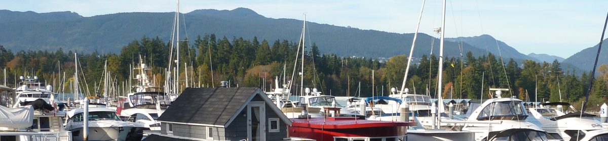
 Great evening at the Royal South Australian Yacht Squadron. Beautiful weather and sunset. Nice dinner and we checked out Wombat II, Brett and Carolyn’ s yacht.
 Explored some of the toe of the Yorke Peninsula today. Awesome coastal scenery, pristine blue ocean waters, sandy beaches, limestone rocks and outcrops, reefs and islands, shipwrecks and wildlife galore. Today we saw emu, kangaroo, numerous scampering lizards and snakes (on the road- one curled up and possibly live and the rest dead and dehydrated).
 Began with spectacular views at Daly Head-reminded me a little of Raglan with steep cliffs to surf beach, rocks and sandy shore. We then headed down into Innes National Park with it’s variegated and low growing coastal bushland. Inneston is a historic town within the park that provided housing and facilities for miners working in factories producing plaster of Paris and chalk. Didn’t have time to explore this trip. The old mines are now lakes.
 Views across the Spencer Gulf and a picnic lunch at Cable Bay, looking out to Chinamans Hat and Haystack Island. Lovely sunny day with a cool wind but the colours in the sea were glorious. Nice walk up to Cape Spencer Lighthouse out of the wind and with stretching views back up the coastline. Heading back up the toe we visited Ethel Beach-great looking surf with demos underway and a shipwreck of the Ethel still visible in the beach. Also went to Pondolowie Bay-again wonderful colours in the coastal scenery and a cute little fishing village as well. Spotted Dad, Mum and Bubs kangaroo lying in the sun just off the track.
 Headed back to Adelaide late avo-had to give way to the emus crossing! They waited politely till we stopped instead of flying out of the bush as they are want to do.
 Roadie to the west of Adelaide today, down the east side of the Yorke Peninsula and across to Couches Beach (east side) where the Ramsey Hill shack is. (Read bach in NZ lingo.)
 Travelled down- pies for lunch at Port Wakefield and checked out a memorial display for a WW1 flying ace at Minlaton. Capt. Harry Butler flew his monoplane “The Red Devil” from Adelaide to Minlaton to deliver the first airmail over water in the Southern Hemisphere in 1919.
 It’s a lot cooler today with a fierce wind so nice to sit by a cosy fire tonight. Quite a change from the heat of a few days ago! BBQ dinner.